CASP Visit CASP website

Main

  • About Us
    • How We Can Help
    • A Bit of History
    • Our Status
    • People
    • Jobs
    • SEM Facility
    • Contact Us
    • News
    • Preventing Harm in Research and Innovation
  • Products
    • Geological Carbon Storage Research
    • Regional Research
    • Reports
    • Data Packages
    • Geological Collections and Data
  • Charity and Education
    • Publications
    • Meetings
    • The Robert Scott Research Fund
    • The Andrew Whitham CASP Fieldwork Awards
    • Outreach
  • Interactive Map
    • Arctic Region
    • China Region
    • East Africa Region
    • North Africa and Middle East Region
    • North Atlantic Region
    • Russia Region
    • South Atlantic Region
    • Southeast Europe to West Central Asia Region

Western Barents Shelf

  1. Home
  2. Regions
  3. Western Barents Shelf

Western Barents Shelf

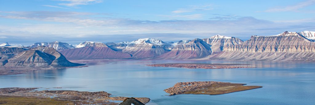
Comprising predominantly thick sedimentary basins, windows into the geological evolution of the western Barents Shelf are spectacularly exposed on the Svalbard archipelago in the north of the region, and are contained in materials recovered from exploration boreholes in the south of the region. How these basins formed and filled is an ongoing area of research that is key for understanding palaeogeography during the formation and break-up of supercontinent Pangea, the location of reservoirs for hydrocarbon reserves and suitable sites for the underground storage of carbon dioxide.

Map of Region

Click here to explore our interactive map

Active Research Projects

  • Barents Shelf Provenance Project 2017-2019
About our projects

Most Recent Reports

  • A review of the crystalline basement of the Barents Shelf and adjacent areas
  • Chronostratigraphic constraints for Triassic sand dispersal on the western Barents Shelf
  • Late Carboniferous to Early Permian reservoir development on the Stappen High: New insight from field and photogrammetric surveys of Bjørnøya
  • Geological history of Bjørnøya through virtual outcrop models
  • A sediment provenance study from the Salina well (7220/10-1)
View a full list of our reports

Interactive Map

  • Arctic Region
    • Canadian-Alaskan Arctic
    • East Greenland and Mid-Norway
    • Western Barents Shelf
    • Eastern Barents Shelf
    • Russian Arctic
  • China Region
    • Northwest China
    • North China
    • South China
  • East Africa Region
  • North Africa and Middle East Region
    • North Africa Region
    • Oman Fracture Research
    • Oman Palaeokarst Research
    • Zagros
  • North Atlantic Region
    • East Greenland and Mid-Norway
    • SE Greenland and Faroe-Shetland Islands
    • Western Barents Shelf
    • Southern North Sea
  • Russia Region
    • Eastern Barents Shelf
    • European Russia
    • Russian Arctic
    • West Siberian Basin
    • Siberian Platform
    • Russian Far East
  • South Atlantic Region
    • Sergipe-Alagoas Basin
    • Neuquén Basin
    • Falkland Islands-Malvinas
    • West and Southern Africa
  • Southeast Europe to West Central Asia Region
    • Dinarides-Hellenides
    • Black Sea Region
    • North Caspian
    • Central Caspian
    • South Caspian
  • © CASP A Not-For-Profit Organisation
  • Charity No. 298729
  • Privacy
  • Cookies
  • Contact Us
  • Jobs
  • LinkedIn