CASP Visit CASP website

Main

  • About Us
    • How We Can Help
    • A Bit of History
    • Our Status
    • People
    • Jobs
    • SEM Facility
    • Contact Us
    • News
    • Preventing Harm in Research and Innovation
  • Products
    • Geological Carbon Storage Research
    • Regional Research
    • Reports
    • Data Packages
    • Geological Collections and Data
  • Charity and Education
    • Publications
    • Meetings
    • The Robert Scott Research Fund
    • The Andrew Whitham CASP Fieldwork Awards
    • Outreach
  • Interactive Map
    • Arctic Region
    • China Region
    • East Africa Region
    • North Africa and Middle East Region
    • North Atlantic Region
    • Russia Region
    • South Atlantic Region
    • Southeast Europe to West Central Asia Region

North Africa Region

  1. Home
  2. Regions
  3. North Africa Region

North Africa Region

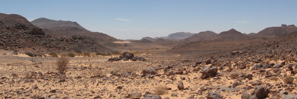
Exploration success in Libya is driven by a world-class Silurian source rock with reservoirs developed in underlying glaciogenic strata. Understanding these two aspects of the geology underpinned CASP research in the basins of southern Libya. As biostratigraphic data are sparse, CASP investigated heavy minerals as a means of testing the lithostratigraphic framework for the region. We also collected structural observations to provide a better framework for understanding the development of these basins from formation to exploration.

Map of Region

Click here to explore our interactive map

Regional Expertise

CASP’s research focused on the Palaeozoic successions in southern Libya exposed at the margins of the Kufra and Murzuq basins. Geologists conducted seven field campaigns in southern Libya between 2006 and 2009, collecting samples and geological observations. This included a shallow drilling programme that collected unweathered material for biostratigraphic work from a borehole 74 m deep in the Kufra Basin. Research in Libya was conducted in partnership with the Maghreb Petroleum Research Group (MPRG) at University College, London, the Earth Science Society of Libya (ESSL) and the Libyan Petroleum Institute (LPI).

Most Recent Reports

  • Summary of the Murzuq Basin Project Phase II with GIS database CASP.MBP.II.19
  • Petrographical, geochemical, geochronological and thermochronological data from Precambrian basement and Phanerozoic igneous rocks in southern Libya CASP.MBP.II.18
  • Heavy mineral data and zircon U-Pb ages from Neoproterozoic-Mesozoic sandstones of the southeastern and northern margins of the Murzuq Basin CASP.MBP.II.17
  • Petrographic study of outcrop samples from the eastern and northern margins of the Murzuq Basin CASP.MBP.II.16
  • Remote sensing analysis of the impact of the Libyan Miocene-to-Holocene Jabal Al Haruj volcanic field on drainage patterns CASP.FBP2012-14.5
View full list of reports

Interactive Map

  • Arctic Region
    • Canadian-Alaskan Arctic
    • East Greenland and Mid-Norway
    • Western Barents Shelf
    • Eastern Barents Shelf
    • Russian Arctic
  • China Region
    • Northwest China
    • North China
    • South China
  • East Africa Region
  • North Africa and Middle East Region
    • North Africa Region
    • Oman Fracture Research
    • Oman Palaeokarst Research
    • Zagros
  • North Atlantic Region
    • East Greenland and Mid-Norway
    • SE Greenland and Faroe-Shetland Islands
    • Western Barents Shelf
    • Southern North Sea
  • Russia Region
    • Eastern Barents Shelf
    • European Russia
    • Russian Arctic
    • West Siberian Basin
    • Siberian Platform
    • Russian Far East
  • South Atlantic Region
    • Sergipe-Alagoas Basin
    • Neuquén Basin
    • Falkland Islands-Malvinas
    • West and Southern Africa
  • Southeast Europe to West Central Asia Region
    • Dinarides-Hellenides
    • Black Sea Region
    • North Caspian
    • Central Caspian
    • South Caspian
  • © CASP A Not-For-Profit Organisation
  • Charity No. 298729
  • Privacy
  • Cookies
  • Contact Us
  • Jobs
  • Twitter
  • LinkedIn