CASP Visit CASP website

Main

  • About Us
    • How We Can Help
    • A Bit of History
    • Our Status
    • People
    • Jobs
    • SEM Facility
    • Contact Us
    • News
    • Preventing Harm in Research and Innovation
  • Products
    • Geological Carbon Storage Research
    • Regional Research
    • Reports
    • Data Packages
    • Geological Collections and Data
  • Charity and Education
    • Publications
    • Meetings
    • The Robert Scott Research Fund
    • The Andrew Whitham CASP Fieldwork Awards
    • Outreach
  • Interactive Map
    • Arctic Region
    • China Region
    • East Africa Region
    • North Africa and Middle East Region
    • North Atlantic Region
    • Russia Region
    • South Atlantic Region
    • Southeast Europe to West Central Asia Region

Russian Far East

  1. Home
  2. Regions
  3. Russian Far East

Russian Far East

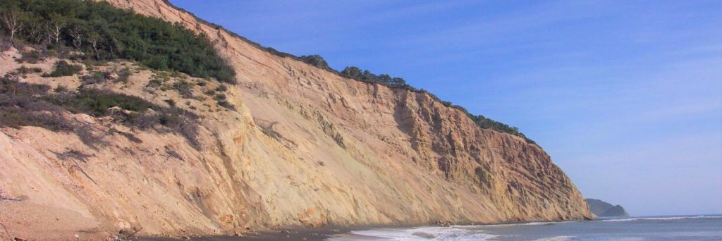
The Russian Far East is a poorly explored and underexploited region close to rapidly expanding Asian energy markets. Sakhalin is the only proven hydrocarbon province. Reservoirs sourced from the palaeo-Amur River are the main exploration target. Other regions, such as the Sea of Okhotsk, are poorly understood and require further investigation.

Map of Region

Click here to explore our interactive map

Regional Expertise

CASP began work in the Russian Far East in 1991 when the first regional synthesis of Sakhalin was produced. This was followed by fieldwork on the island between 1996 and 2004. The focus of this work was the influence of Cenozoic tectonic activity on sand supply from the palaeo-Amur River to the north Sakhalin and Deryugin basins. The approach adopted was multidisciplinary and involved the integration of structural and sedimentological field observations with seismic and biostratigraphic datasets. This regional expertise also enabled an evaluation of all aspects of the petroleum system along the northern and western margins of the Sea of Okhotsk to be made. The results cover key aspects of the formation of basins within the Sea of Okhotsk, including basin formation, sand distribution and quality, sediment provenance and timing of sediment deposition.

Most Recent Reports

  • Silurian black shales in Russia: A review CASP.SIL2012-13.1
  • Structural and tectonic evolution of Severnaya Zemlya CASP.SZP2009-11.10
  • The Ellesmerian orogenic event (Late Devonian to Early Carboniferous) in Russia: evidence and significance. Part 2: Siberia to Chukotka CASP.ARDP2008-10.15
  • The heavy mineral characteristics of Tertiary sands on Sakhalin and a comparison with sands from the modern Amur River CASP.SakProv.1
  • A review of sediment supply to the northern Sea of Okhotsk through the Late Mesozoic and Cenozoic CASP.NSOP.2
View a full list of our reports

Interactive Map

  • Arctic Region
    • Canadian-Alaskan Arctic
    • East Greenland and Mid-Norway
    • Western Barents Shelf
    • Eastern Barents Shelf
    • Russian Arctic
  • China Region
    • Northwest China
    • North China
    • South China
  • East Africa Region
  • North Africa and Middle East Region
    • North Africa Region
    • Oman Fracture Research
    • Oman Palaeokarst Research
    • Zagros
  • North Atlantic Region
    • East Greenland and Mid-Norway
    • SE Greenland and Faroe-Shetland Islands
    • Western Barents Shelf
    • Southern North Sea
  • Russia Region
    • Eastern Barents Shelf
    • European Russia
    • Russian Arctic
    • West Siberian Basin
    • Siberian Platform
    • Russian Far East
  • South Atlantic Region
    • Sergipe-Alagoas Basin
    • Neuquén Basin
    • Falkland Islands-Malvinas
    • West and Southern Africa
  • Southeast Europe to West Central Asia Region
    • Dinarides-Hellenides
    • Black Sea Region
    • North Caspian
    • Central Caspian
    • South Caspian
  • © CASP A Not-For-Profit Organisation
  • Charity No. 298729
  • Privacy
  • Cookies
  • Contact Us
  • Jobs
  • Twitter
  • LinkedIn